
Reference overview
The Town of Beyşehir
Josh · The Art of Wayfaring
Read the place guides and stories that draw on this source.
Read with your device’s voice.
Mada Island
The lake’s largest island, home to fisheries, island agriculture and traditional life.
Mada, Kazak and Kumluca are names attached to the same inhabited island in the northern part of Lake Beyşehir. Each opens a different historical perspective: an older place-name, the memory of Don Cossack settlement, and the sandy shoreline associated with Kumluca. The island lies near Gedikli and belongs administratively to Şarkikaraağaç in Isparta. Lake geography connects it with Beyşehir, but the town’s name should not obscure that different administrative setting.
The island’s human history began long before the Cossacks. Hüseyin Muşmal’s 2024 settlement study draws on Ottoman registers, earlier scholarship and accounts of island life. A register from 1507 records both Muslim and non-Muslim households. Those categories describe the administration’s entries at that date, not an unchanging population across the following centuries. Fresh water, cultivable ground, grazing and access to fish help explain why successive communities sought a livelihood here.
The word Kazak requires translation with care. In this story it means Don Cossack, not a person from modern Kazakhstan. The migrants were part of the wider Cossack movements through the Ottoman world, including the Old Believer and Nekrasov histories studied around Lake Manyas. Old Believers preserved earlier Russian Orthodox rites after seventeenth-century church reforms; the Nekrasov name recalls the leader followed by Cossacks who left the Don region after the conflicts of 1708. Religious practice, political conflict and community autonomy all shaped those journeys. The Chechen families later associated with Mada belonged to a different migration history; proximity on a map does not make them one people.
The local chronology centres on the mid-1860s. The Ministry of Culture and Tourism describes the settlement of 30–40 Don Cossack households in 1866. The 2024 study also discusses an account of a journey from Manyas in 1865, while other scholarship places settlement in the winter of 1866–1867. These accounts should not be compressed into a falsely exact arrival date or treated as identical headcounts. Together they establish a movement from the Manyas community towards the Beyşehir lake basin.
The journey account includes livestock, carts and young fruit trees among the belongings carried south. Such details change the image of migration: people were transporting the means to establish a household and a working landscape. Mada offered fresh water and land alongside access to the lake. Settlement nevertheless depended on links beyond the shore, because tools, trade, official decisions and family connections could not all be supplied within an island community.
Fishing occupies a prominent place in both the official account and the historical research. Large wooden boats known as karakayık form part of the remembered material culture of Cossack fishing on these lakes. Their significance lies in the relationship between craft, fishing knowledge and transport. This does not mean fishing began on Lake Beyşehir with one incoming group. It identifies a contribution within a much longer history of people making their living from the water.
Island life combined several activities. Agricultural plots, animals, boats and landing places belonged to a connected working environment, rather than separate picturesque scenes. A calm view across the water can conceal the effort of transporting provisions or taking produce to market. Historical descriptions of weather, disease and economic difficulty remind us that the same lake could provide resources and complicate daily life. The island’s history is therefore also a history of dependence on the surrounding shore.
The Cossack population did not remain unchanged. Research describes illness, returns to Manyas and movement towards the Akşehir area; by the 1920s the island community’s circumstances had altered substantially. Some Cossacks continued to fish on Lake Beyşehir after relocating. The well-known departure from Manyas in 1962 belongs to that other community’s later history and should not be used as a blanket date for the end of Cossack settlement on Mada.
Later accounts record Chechen families on the island, followed by Yörük settlement, including families identified as Tırtar. The 2024 study describes changes of residence and landholding in the 1930s and subsequent settlement. These episodes belong together in a history of the island, but not in a single ethnic origin story. The accompanying article Chechens and Ingush in Beyşehir: Hamidiye’s Memory follows the better-documented town settlement and its cemetery evidence.
Names and ruins need the same care. Nearby Kirse or Kilise Island is a separate place, and historical interpretations of its remains are not unanimous. It should not be silently merged with Mada or with the better-known Kız Kalesi site elsewhere on the lake. Nor does the name Kazak prove the age or use of every surviving wall. Archaeology, travel accounts and oral traditions can illuminate one another without being interchangeable forms of evidence.
Mada is also a place where people live and work. Its homes, fields and waterfront spaces are not an open-air set left behind by a vanished community. Any visit depends on current local arrangements, weather and permission where land is private; the historical use of boats does not establish a scheduled passenger service. This article is cultural reading, not a verified island walking route, and it makes no recommendation to cross frozen water.
Read the wider lake article alongside this history to connect settlement with shorelines and transport. Water and City: Beyşehir’s Waterfront History then shifts attention to the town outlet and its irrigation works, while the palace article introduces a very different form of lakeside occupation. Together these stories show why an island cannot be understood from one label alone: inhabitants, livelihoods and connections changed, while the lake remained the shared setting for those changes.
Life on the Lake Islands
Centuries of fishing, island fortresses and traditions across the lake’s 33 islands.
From shore, Lake Beyşehir’s islands can look like similar dark shapes against the water. Written accounts reveal a more varied landscape. Some describe settlement and livelihood, others coves, caves or surviving buildings. Each island has a character shaped by its own history and terrain, rather than simply a place in a boat-tour checklist.
The municipal guide identifies Mada with an inhabited island landscape. Research on the lake’s history adds changes over time to that description. It does not follow that residents form a timeless, isolated community. Connections with the mainland and changes in livelihood deserve investigation instead of being replaced by a romantic image of an unchanging fishing village.
Kız Kalesi raises different questions because building remains are central to its description. A distant view, a publication image and an archaeological account provide different evidence. Ruins establish the presence of structures; appearance alone cannot identify every occupant or prove a colourful story about royal life. Likewise, a cave or cove described on one island should not be borrowed to illustrate another.
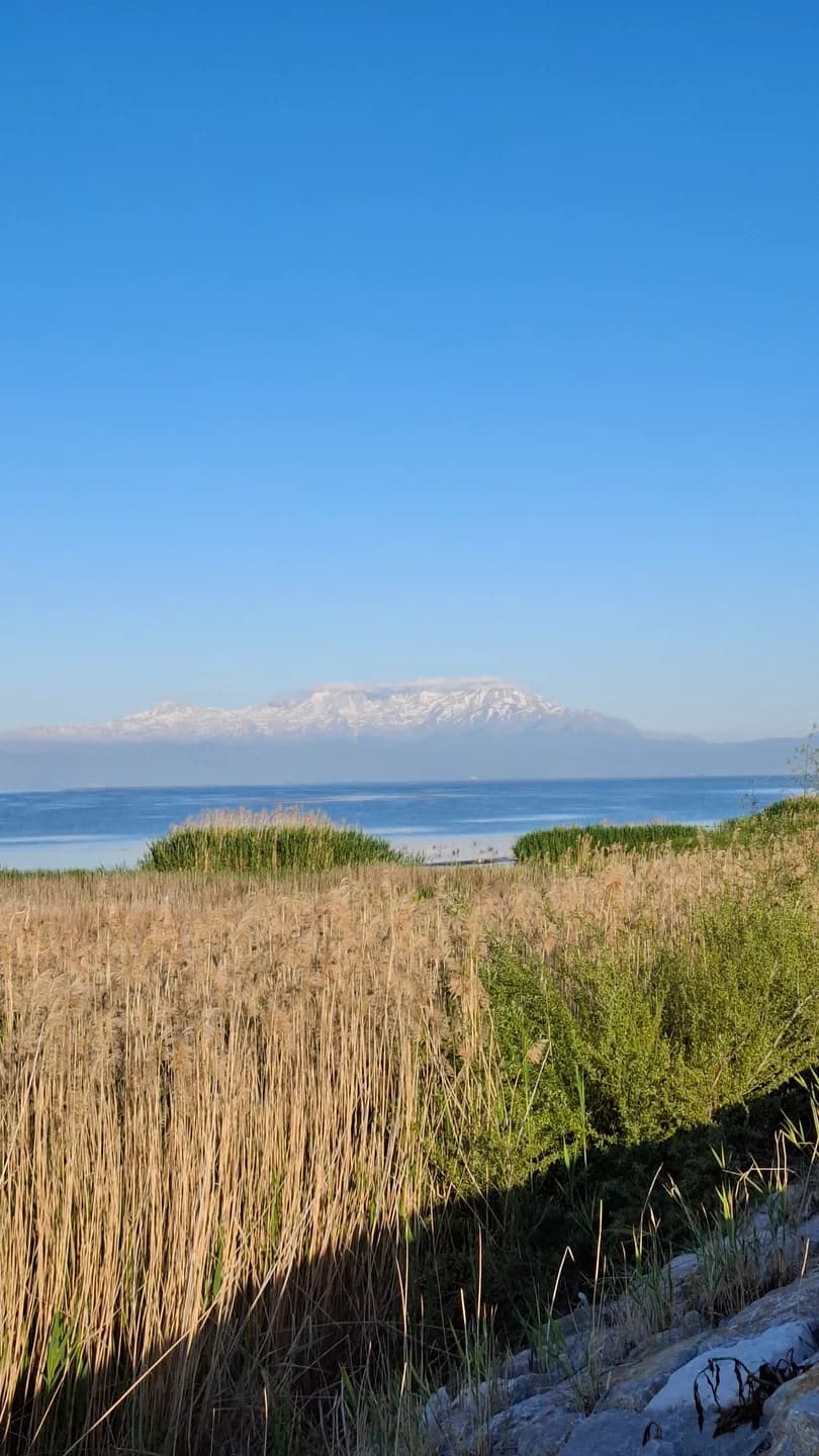
The illustrations distinguish island remains from a general lake panorama, which provides context without documenting every island. Check boat availability, landing arrangements, permissions and weather for the specific outing. The map offers a geographical overview rather than a sailing track. Time spent looking from shore is valuable too: an island’s relationship with the mainland belongs to its story even when landing is not possible.
Begin with an island's outline in relation to the mainland. A narrow strip of visible water, a distant ridge or a sheltered-looking bay changes how the landform is perceived. Make a simple sketch before looking for buildings. It can help distinguish the island's overall shape from a foreground shore that overlaps it in a photograph.
The name of a place is another useful anchor. Keep the name used by your source or local host alongside any alternative spelling. A description of a cave, a settlement or a ruin becomes much more useful when the exact island remains clear. Avoid collecting attractive details into a single imaginary island.
An inhabited island should be approached as a community as well as a destination. When a visit is possible, ask where visitors may walk and photograph, and allow everyday work to continue around you. A landing point does not make gardens, homes or working spaces public attractions.
Follow the lake story back towards the shore after reading about the islands. Palace tiles introduces another relationship between buildings and water at Kubad-Abad, while Yeşildağ's storks and horses draws attention to seasonal life around the margins. Together these accounts make the lake a network of different places rather than a list of interchangeable stops.
Beyşehir in Travelers’ Accounts
Eastern and Western voyagers describing Eşrefoğlu Mosque, Kubadabad tiles and island communities.
Travel writing offers an earlier Beyşehir through the choices of people passing through. One visitor notices a building, another a crossing or the circumstances of a stay. These observations can be valuable, but they are selections rather than a complete inventory. Reading them beside the present-day town is a rewarding exercise precisely because the views differ.
Hüseyin Muşmal’s study compares travel accounts and works of historical geography. Descriptions from different dates and purposes reveal changes in emphasis as well as possible changes in places. A memorable sentence cannot carry a neighbourhood’s entire history. Nor should a later summary be mistaken for the original traveller’s exact words.
The writer’s position matters. A short-term visitor and a resident do not see the same town, and an account may have been edited or translated long after the journey. Travel date, publication date and photograph date are different evidence. The historical aerial illustration here provides urban context; it does not prove a traveller’s precise route or establish every old street name’s modern equivalent.
Choose one visible feature and compare its treatment in the sources. Ask what a writer observed directly and what was reported second-hand. Avoid turning an uncertain identification into a plaque-like certainty. Moving between place and text while retaining differences between witnesses produces a richer reading walk than collecting quotations detached from their setting.
Read a travel account with a small set of questions in mind: who is speaking, when did the visit take place and what brought the writer to the town? A description prepared for other travellers may notice different things from a geographical survey or a personal recollection.
Choose a recognisable subject, such as the lake or a crossing, and compare how two accounts frame it. One may emphasise movement, another appearance or the circumstances of a stay. Difference is useful evidence of perspective, even when neither passage can settle a precise architectural question.
Then make your own short description from a public viewpoint. Record the date and distinguish what you saw from what you had already read. Revisiting that note afterwards is a practical way to understand how every account selects and arranges details, including your own.
Market memory and Water and city offer places for this exercise, while Wartime Beyşehir introduces a very different kind of temporary presence. Read the journeys in their own circumstances rather than treating every visitor as a tourist. The reason someone arrived shapes what their account can tell us.
Related places
- Eşrefoğlu Mosque
- Lake Beyşehir
- Kubadabad Palace
- Kız Kalesi Island
- Mada Island
- Hacıâkif Island
- İğdeli Island