
Reference overview
Tarihî Süreçte Beyşehir Gölü ve Adalarında Hayat (Nüsha 2)
Berna Burcu Üçüncü, Hüseyin Muşmal · Palet Yayınları
Read the place guides and stories that draw on this source.
Read with your device’s voice.
Mada, Hacı Akif and the lake islands
Island life, coves and architectural traces in the lake landscape.
From shore, Lake Beyşehir’s islands can look like similar dark shapes against the water. Written accounts reveal a more varied landscape. Some describe settlement and livelihood, others coves, caves or surviving buildings. Each island has a character shaped by its own history and terrain, rather than simply a place in a boat-tour checklist.
The municipal guide identifies Mada with an inhabited island landscape. Research on the lake’s history adds changes over time to that description. It does not follow that residents form a timeless, isolated community. Connections with the mainland and changes in livelihood deserve investigation instead of being replaced by a romantic image of an unchanging fishing village.
Kız Kalesi raises different questions because building remains are central to its description. A distant view, a publication image and an archaeological account provide different evidence. Ruins establish the presence of structures; appearance alone cannot identify every occupant or prove a colourful story about royal life. Likewise, a cave or cove described on one island should not be borrowed to illustrate another.
The illustrations distinguish island remains from a general lake panorama, which provides context without documenting every island. Check boat availability, landing arrangements, permissions and weather for the specific outing. The map offers a geographical overview rather than a sailing track. Time spent looking from shore is valuable too: an island’s relationship with the mainland belongs to its story even when landing is not possible.
Begin with an island's outline in relation to the mainland. A narrow strip of visible water, a distant ridge or a sheltered-looking bay changes how the landform is perceived. Make a simple sketch before looking for buildings. It can help distinguish the island's overall shape from a foreground shore that overlaps it in a photograph.
The name of a place is another useful anchor. Keep the name used by your source or local host alongside any alternative spelling. A description of a cave, a settlement or a ruin becomes much more useful when the exact island remains clear. Avoid collecting attractive details into a single imaginary island.
An inhabited island should be approached as a community as well as a destination. When a visit is possible, ask where visitors may walk and photograph, and allow everyday work to continue around you. A landing point does not make gardens, homes or working spaces public attractions.
Follow the lake story back towards the shore after reading about the islands. Palace tiles introduces another relationship between buildings and water at Kubad-Abad, while Yeşildağ's storks and horses draws attention to seasonal life around the margins. Together these accounts make the lake a network of different places rather than a list of interchangeable stops.
Arrange boat times, island permissions, safe boarding and weather limits with a licensed operator.
Lake Beyşehir
Slow down among shores, islands and changing light.
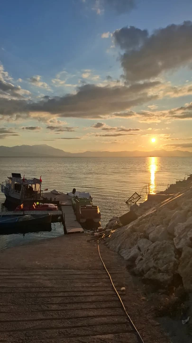
Lake Beyşehir does not have one definitive view. A broad horizon from town, a reed-fringed edge, a field above the water and the outline of an island describe different places within the same lake landscape. Begin by noticing the foreground. It tells you whether you are looking from a built waterfront, a working shore or a quieter habitat, and gives the distant panorama a particular local meaning.
The lake extends across the provinces of Konya and Isparta. This wider geography is useful when planning an outing: a place associated with Lake Beyşehir may be well beyond the town's immediate waterfront. Read the regional atlas before choosing stops, then distinguish the journey by road from time spent walking. A circuit of attractive names on a screen is not automatically a comfortable day's itinerary.
At the town shore, water and settlement are close together. Look at how streets approach the lake, where people pause and how the view opens after more enclosed urban spaces. The transition from İçerişehir to the waterfront can be as memorable as a single landmark. Architecture frames the water for a moment, then gives way to a horizon that is much larger than the town around you.
Taş Köprü adds an engineered edge to this encounter. The bridge and regulator introduce the relationship between crossing water and managing its flow. Read Water and city beside the lake view to connect the familiar arches with a regional history of irrigation. The lake is both a visible landscape and part of systems that reach beyond the immediate scene.
Elsewhere, reeds and open ground change the appearance of the boundary. Water may be partly hidden, and the most interesting photograph may contain little blue surface at all. Notice the direction of stems, the uneven line of vegetation and the different textures of cultivated and uncultivated land. Looking at these transitions helps replace the idea of one empty shoreline with a more varied place.
Historical research on the lake and its islands brings settlement and livelihood into the picture. A boat, a landing place or equipment seen from a public path can prompt questions about work and movement. Ask permission before photographing people closely, and attribute any explanation to the person who offered it. One conversation can enrich a visit without being presented as the experience of every household around the lake.
Islands bring another change in scale. From a distance they may appear as similar silhouettes; the Island communities story explains why their identities and histories should remain distinct. Mada's settlement, the remains associated with Kız Kalesi and the different shore forms described in municipal accounts invite different kinds of attention. A view from land is already a meaningful encounter with these relationships.
Yeşildağ adds a seasonal chapter through its nesting landscape. The stork story encourages a patient visit with attention to trees, fields and wildlife rather than a promise of a particular sighting. Read it alongside the lake panorama: the wide water surface and the small occupied nest are different scales of the same regional experience. Neither alone provides the whole account.
Photographs become more useful when they record change. Choose a public viewpoint that is easy to describe and include a fixed feature, such as a distant ridge or recognisable building. Note the date and conditions. Returning to that position may reveal differences in reflections, vegetation and human activity, without requiring you to draw conclusions about the lake's long-term condition from just two images.
For a first visit, consider a simple sequence: a waterfront pause, the bridge viewed from a public position, and one additional shore destination whose access you have checked. Leave enough time to stop and look rather than constantly travelling. If an island landing or a particular activity is unavailable, a shore-based day can still be complete; the water does not need to be crossed to be understood.
Check current conditions for swimming, boating or camping separately from this landscape account. An older tourism description does not confirm an operating service or an authorised access point today. Use established public approaches, respect working land and give wildlife room. Take your waste away, including small food packaging that can easily be overlooked after a windy stop.
Continue with Water and city for the regulator, Island communities for settlement across the water, and Yeşildağ's storks and horses for the rural edge. Palace tiles introduces Kubad-Abad, where the lake setting becomes part of an architectural story. These connections turn a panoramic stop into a longer reading of Beyşehir: water, buildings, work and living habitats seen together.
Kız Kalesi Island
A historic island fortress across from the palace, home to defensive walls and bird colonies.
From shore, Lake Beyşehir’s islands can look like similar dark shapes against the water. Written accounts reveal a more varied landscape. Some describe settlement and livelihood, others coves, caves or surviving buildings. Each island has a character shaped by its own history and terrain, rather than simply a place in a boat-tour checklist.
The municipal guide identifies Mada with an inhabited island landscape. Research on the lake’s history adds changes over time to that description. It does not follow that residents form a timeless, isolated community. Connections with the mainland and changes in livelihood deserve investigation instead of being replaced by a romantic image of an unchanging fishing village.
Kız Kalesi raises different questions because building remains are central to its description. A distant view, a publication image and an archaeological account provide different evidence. Ruins establish the presence of structures; appearance alone cannot identify every occupant or prove a colourful story about royal life. Likewise, a cave or cove described on one island should not be borrowed to illustrate another.
The illustrations distinguish island remains from a general lake panorama, which provides context without documenting every island. Check boat availability, landing arrangements, permissions and weather for the specific outing. The map offers a geographical overview rather than a sailing track. Time spent looking from shore is valuable too: an island’s relationship with the mainland belongs to its story even when landing is not possible.
Begin with an island's outline in relation to the mainland. A narrow strip of visible water, a distant ridge or a sheltered-looking bay changes how the landform is perceived. Make a simple sketch before looking for buildings. It can help distinguish the island's overall shape from a foreground shore that overlaps it in a photograph.
The name of a place is another useful anchor. Keep the name used by your source or local host alongside any alternative spelling. A description of a cave, a settlement or a ruin becomes much more useful when the exact island remains clear. Avoid collecting attractive details into a single imaginary island.
An inhabited island should be approached as a community as well as a destination. When a visit is possible, ask where visitors may walk and photograph, and allow everyday work to continue around you. A landing point does not make gardens, homes or working spaces public attractions.
Follow the lake story back towards the shore after reading about the islands. Palace tiles introduces another relationship between buildings and water at Kubad-Abad, while Yeşildağ's storks and horses draws attention to seasonal life around the margins. Together these accounts make the lake a network of different places rather than a list of interchangeable stops.
Hacıâkif Island
A nature island in the southwest lake featuring a karst cave and dense vegetation.
From shore, Lake Beyşehir’s islands can look like similar dark shapes against the water. Written accounts reveal a more varied landscape. Some describe settlement and livelihood, others coves, caves or surviving buildings. Each island has a character shaped by its own history and terrain, rather than simply a place in a boat-tour checklist.
The municipal guide identifies Mada with an inhabited island landscape. Research on the lake’s history adds changes over time to that description. It does not follow that residents form a timeless, isolated community. Connections with the mainland and changes in livelihood deserve investigation instead of being replaced by a romantic image of an unchanging fishing village.
Kız Kalesi raises different questions because building remains are central to its description. A distant view, a publication image and an archaeological account provide different evidence. Ruins establish the presence of structures; appearance alone cannot identify every occupant or prove a colourful story about royal life. Likewise, a cave or cove described on one island should not be borrowed to illustrate another.
The illustrations distinguish island remains from a general lake panorama, which provides context without documenting every island. Check boat availability, landing arrangements, permissions and weather for the specific outing. The map offers a geographical overview rather than a sailing track. Time spent looking from shore is valuable too: an island’s relationship with the mainland belongs to its story even when landing is not possible.
Begin with an island's outline in relation to the mainland. A narrow strip of visible water, a distant ridge or a sheltered-looking bay changes how the landform is perceived. Make a simple sketch before looking for buildings. It can help distinguish the island's overall shape from a foreground shore that overlaps it in a photograph.
The name of a place is another useful anchor. Keep the name used by your source or local host alongside any alternative spelling. A description of a cave, a settlement or a ruin becomes much more useful when the exact island remains clear. Avoid collecting attractive details into a single imaginary island.
An inhabited island should be approached as a community as well as a destination. When a visit is possible, ask where visitors may walk and photograph, and allow everyday work to continue around you. A landing point does not make gardens, homes or working spaces public attractions.
Follow the lake story back towards the shore after reading about the islands. Palace tiles introduces another relationship between buildings and water at Kubad-Abad, while Yeşildağ's storks and horses draws attention to seasonal life around the margins. Together these accounts make the lake a network of different places rather than a list of interchangeable stops.
İğdeli Island
A relaxation island with natural swimming beaches and an 1,184 m summit.
From shore, Lake Beyşehir’s islands can look like similar dark shapes against the water. Written accounts reveal a more varied landscape. Some describe settlement and livelihood, others coves, caves or surviving buildings. Each island has a character shaped by its own history and terrain, rather than simply a place in a boat-tour checklist.
The municipal guide identifies Mada with an inhabited island landscape. Research on the lake’s history adds changes over time to that description. It does not follow that residents form a timeless, isolated community. Connections with the mainland and changes in livelihood deserve investigation instead of being replaced by a romantic image of an unchanging fishing village.
Kız Kalesi raises different questions because building remains are central to its description. A distant view, a publication image and an archaeological account provide different evidence. Ruins establish the presence of structures; appearance alone cannot identify every occupant or prove a colourful story about royal life. Likewise, a cave or cove described on one island should not be borrowed to illustrate another.
The illustrations distinguish island remains from a general lake panorama, which provides context without documenting every island. Check boat availability, landing arrangements, permissions and weather for the specific outing. The map offers a geographical overview rather than a sailing track. Time spent looking from shore is valuable too: an island’s relationship with the mainland belongs to its story even when landing is not possible.
Begin with an island's outline in relation to the mainland. A narrow strip of visible water, a distant ridge or a sheltered-looking bay changes how the landform is perceived. Make a simple sketch before looking for buildings. It can help distinguish the island's overall shape from a foreground shore that overlaps it in a photograph.
The name of a place is another useful anchor. Keep the name used by your source or local host alongside any alternative spelling. A description of a cave, a settlement or a ruin becomes much more useful when the exact island remains clear. Avoid collecting attractive details into a single imaginary island.
An inhabited island should be approached as a community as well as a destination. When a visit is possible, ask where visitors may walk and photograph, and allow everyday work to continue around you. A landing point does not make gardens, homes or working spaces public attractions.
Follow the lake story back towards the shore after reading about the islands. Palace tiles introduces another relationship between buildings and water at Kubad-Abad, while Yeşildağ's storks and horses draws attention to seasonal life around the margins. Together these accounts make the lake a network of different places rather than a list of interchangeable stops.
The changing rhythm of the lake
Returning to the same shore in different seasons.
Lake Beyşehir does not have one definitive view. A broad horizon from town, a reed-fringed edge, a field above the water and the outline of an island describe different places within the same lake landscape. Begin by noticing the foreground. It tells you whether you are looking from a built waterfront, a working shore or a quieter habitat, and gives the distant panorama a particular local meaning.
The lake extends across the provinces of Konya and Isparta. This wider geography is useful when planning an outing: a place associated with Lake Beyşehir may be well beyond the town's immediate waterfront. Read the regional atlas before choosing stops, then distinguish the journey by road from time spent walking. A circuit of attractive names on a screen is not automatically a comfortable day's itinerary.
At the town shore, water and settlement are close together. Look at how streets approach the lake, where people pause and how the view opens after more enclosed urban spaces. The transition from İçerişehir to the waterfront can be as memorable as a single landmark. Architecture frames the water for a moment, then gives way to a horizon that is much larger than the town around you.
Taş Köprü adds an engineered edge to this encounter. The bridge and regulator introduce the relationship between crossing water and managing its flow. Read Water and city beside the lake view to connect the familiar arches with a regional history of irrigation. The lake is both a visible landscape and part of systems that reach beyond the immediate scene.
Elsewhere, reeds and open ground change the appearance of the boundary. Water may be partly hidden, and the most interesting photograph may contain little blue surface at all. Notice the direction of stems, the uneven line of vegetation and the different textures of cultivated and uncultivated land. Looking at these transitions helps replace the idea of one empty shoreline with a more varied place.
Historical research on the lake and its islands brings settlement and livelihood into the picture. A boat, a landing place or equipment seen from a public path can prompt questions about work and movement. Ask permission before photographing people closely, and attribute any explanation to the person who offered it. One conversation can enrich a visit without being presented as the experience of every household around the lake.
Islands bring another change in scale. From a distance they may appear as similar silhouettes; the Island communities story explains why their identities and histories should remain distinct. Mada's settlement, the remains associated with Kız Kalesi and the different shore forms described in municipal accounts invite different kinds of attention. A view from land is already a meaningful encounter with these relationships.
Yeşildağ adds a seasonal chapter through its nesting landscape. The stork story encourages a patient visit with attention to trees, fields and wildlife rather than a promise of a particular sighting. Read it alongside the lake panorama: the wide water surface and the small occupied nest are different scales of the same regional experience. Neither alone provides the whole account.
Photographs become more useful when they record change. Choose a public viewpoint that is easy to describe and include a fixed feature, such as a distant ridge or recognisable building. Note the date and conditions. Returning to that position may reveal differences in reflections, vegetation and human activity, without requiring you to draw conclusions about the lake's long-term condition from just two images.
For a first visit, consider a simple sequence: a waterfront pause, the bridge viewed from a public position, and one additional shore destination whose access you have checked. Leave enough time to stop and look rather than constantly travelling. If an island landing or a particular activity is unavailable, a shore-based day can still be complete; the water does not need to be crossed to be understood.
Check current conditions for swimming, boating or camping separately from this landscape account. An older tourism description does not confirm an operating service or an authorised access point today. Use established public approaches, respect working land and give wildlife room. Take your waste away, including small food packaging that can easily be overlooked after a windy stop.
Continue with Water and city for the regulator, Island communities for settlement across the water, and Yeşildağ's storks and horses for the rural edge. Palace tiles introduces Kubad-Abad, where the lake setting becomes part of an architectural story. These connections turn a panoramic stop into a longer reading of Beyşehir: water, buildings, work and living habitats seen together.
Life on the Lake Islands
Centuries of fishing, island fortresses and traditions across the lake’s 33 islands.
From shore, Lake Beyşehir’s islands can look like similar dark shapes against the water. Written accounts reveal a more varied landscape. Some describe settlement and livelihood, others coves, caves or surviving buildings. Each island has a character shaped by its own history and terrain, rather than simply a place in a boat-tour checklist.
The municipal guide identifies Mada with an inhabited island landscape. Research on the lake’s history adds changes over time to that description. It does not follow that residents form a timeless, isolated community. Connections with the mainland and changes in livelihood deserve investigation instead of being replaced by a romantic image of an unchanging fishing village.
Kız Kalesi raises different questions because building remains are central to its description. A distant view, a publication image and an archaeological account provide different evidence. Ruins establish the presence of structures; appearance alone cannot identify every occupant or prove a colourful story about royal life. Likewise, a cave or cove described on one island should not be borrowed to illustrate another.
The illustrations distinguish island remains from a general lake panorama, which provides context without documenting every island. Check boat availability, landing arrangements, permissions and weather for the specific outing. The map offers a geographical overview rather than a sailing track. Time spent looking from shore is valuable too: an island’s relationship with the mainland belongs to its story even when landing is not possible.
Begin with an island's outline in relation to the mainland. A narrow strip of visible water, a distant ridge or a sheltered-looking bay changes how the landform is perceived. Make a simple sketch before looking for buildings. It can help distinguish the island's overall shape from a foreground shore that overlaps it in a photograph.
The name of a place is another useful anchor. Keep the name used by your source or local host alongside any alternative spelling. A description of a cave, a settlement or a ruin becomes much more useful when the exact island remains clear. Avoid collecting attractive details into a single imaginary island.
An inhabited island should be approached as a community as well as a destination. When a visit is possible, ask where visitors may walk and photograph, and allow everyday work to continue around you. A landing point does not make gardens, homes or working spaces public attractions.
Follow the lake story back towards the shore after reading about the islands. Palace tiles introduces another relationship between buildings and water at Kubad-Abad, while Yeşildağ's storks and horses draws attention to seasonal life around the margins. Together these accounts make the lake a network of different places rather than a list of interchangeable stops.
Related places
·