
Reference overview
Beyşehir Gölü / The Lake Beyşehir
Beyşehir Belediyesi · Beyşehir Belediyesi
Read the place guides and stories that draw on this source.
Read with your device’s voice.
Karaburun shore
Shoreline and outdoor planning around the lake.
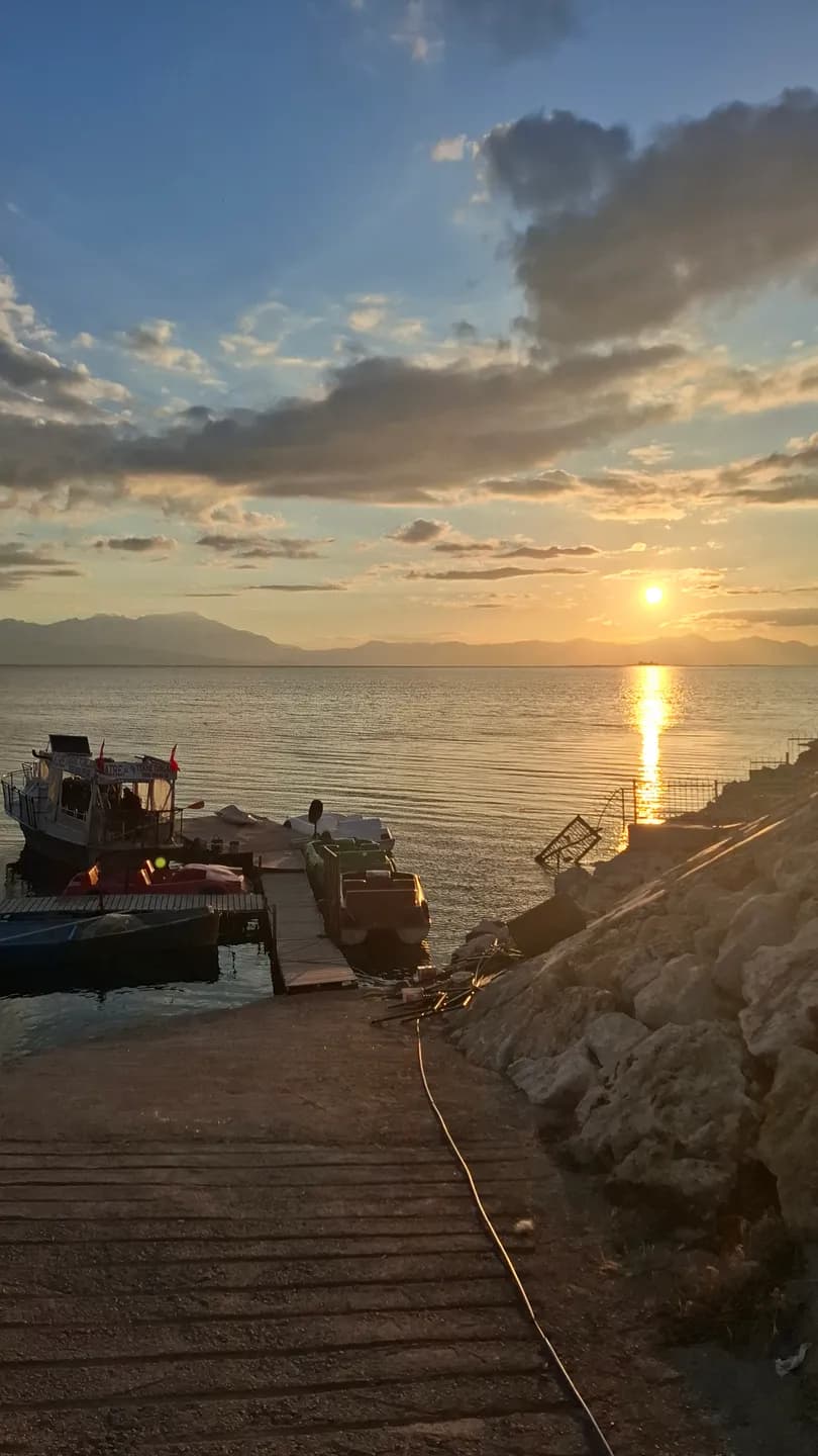
Karaburun is one of the shore destinations named in Beyşehir's municipal guide. It introduces a different way of spending time beside the lake from the town-centre promenade. Begin with the meeting of land and water: the shape of the edge, the direction of the open view and the use of the ground around it.
A beach destination can be read as landscape before an activity is chosen. Look at what lies immediately behind the shore as well as ahead across the lake. Vegetation, tracks and neighbouring uses give the place a setting that disappears when a photograph includes only water and sky.
The municipality introduces Karaburun as a shore destination. Plan the day around the public approach, current facilities and activities you want to enjoy. Ask the responsible authority about swimming conditions, camping permission and seasonal services. A clear plan lets you spend time beside the water, choosing a stopping place that suits your group and the weather.
For a relaxed visit, choose a clear start and return point and leave time for an unhurried pause. A short walk and a period of sitting can be a complete outing. Adjust the plan to the wind, light and condition of the path rather than trying to reproduce someone else's photograph.
Photography here can connect small details with the wider basin. Try a view that includes the shoreline texture in the foreground, then another that gives the distant skyline more space. Note where you stood. The pair will explain the place more clearly than several nearly identical horizon shots.
If you bring food, choose a permitted stopping place and keep the shoreline clear afterwards. Respect nearby working land, avoid disturbing vegetation and give wildlife space. A public approach does not make every adjoining patch of ground available for a picnic or a shortcut.
Lake life connects this visit with the varied edges of the basin. Photography and birdwatching introduces other ways of looking, while Water and city offers the more built setting around the regulator. Each is a separate encounter with the same lake rather than a substitute for the others.
Use the atlas to understand those relationships and the route pages to check the limits of each proposed outing. A satisfying shoreline day can be modest in distance but rich in observation, with enough time to notice how the water changes and how this particular edge differs from the one seen from town.
Check water quality, lifeguard provision, camping permission and seasonal closures with the responsible authority.
Sunset and birdwatching
Observation themes from Taş Köprü to the Valley of Storks.
Yeşildağ asks you to change the scale of a lake visit. In central Beyşehir, water is a wide horizon beyond the waterfront; here, attention can settle on a tree, the outline of a nest or a bird crossing a field. The interest lies in those relationships. A stork landscape makes sense when its nesting places, surrounding countryside and the people who use that countryside remain in the same picture.
Leylekler Vadisi lies by Yeşildağ, a lakeside settlement that the municipality places about 30 kilometres from Beyşehir. The municipal guide distinguishes its colony from Adaköy, where another nesting area is known as Leylekler Tepesi. These names matter when planning a visit: two nearby communities share the wider stork landscape, but a photograph or meeting point for one should not become directions to the other.
The distinctive nesting trees are junipers. A field account published by Konya's agriculture directorate describes nests among the trees of Yeşildağ's burial grounds and records local efforts to support nesting. This gives the scene a particular character: the birds occupy a place that also holds human memory. Observe quietly from permitted ground, with the same respect for graves and visitors that you would bring to any cemetery.
The colony follows a seasonal rhythm rather than a visitor timetable. The official field account recalls arriving on an August day after the birds had already left. A separate report published by the Presidency's communications directorate documents returning birds encountering snow in March 2025. These dated moments show the colony’s seasonal setting. Ask locally about bird activity before travelling, dress for the day’s weather and leave time to observe the surrounding trees and fields as well as the nests.
The horse photographs introduce another encounter in the wider lake landscape: animals grazing beside the water when the pictures were taken. Read the views as dated observations of countryside life. Look at the relationship between open ground, the herd and the shoreline, and note the place and season of each image. This wider setting complements the stork colony’s trees and nests.
If horses are present, allow them space to choose their own movement. Watch from an existing public position, keep a clear route past them and leave gates as you found them. Do not offer food or approach to arrange a photograph. An image of an animal beside water can be striking without requiring a close encounter, and farmland continues to be someone's working environment even when it looks wonderfully open.
Yeşildağ also belongs to a working lake economy. The agriculture directorate's account describes farming, livestock keeping and fishing in the settlement. Fields and grazing animals therefore deserve attention alongside nests: they are part of the place's daily life. Look at how cultivated ground, trees and water meet, and how the mountain backdrop gives scale to activities that might be missed in a photograph framed only around a bird.
The Anamas foothill setting connects the colony with the wooded country beyond the shore. GoKonya's İslibucak guide describes approaches through the Yeşildağ area towards Dumanlı and Kurucuova. That is a useful geographical connection for a longer visit: the stork landscape, village approaches and forest country can be read together, while each outing keeps its own travel plan and current access information.
An enjoyable visit can be organised around a modest aim: one quiet viewpoint, time to watch, and a return point agreed before you set out. Plan travel from town separately from the short time spent on foot. Arrange transport from Beyşehir to Leylekler Vadisi, then choose a permitted public viewpoint for your time on foot. The atlas locates the area; local signs and access arrangements guide your approach.
Bring water, sun protection and a way to keep your notes available without a connection. If you are travelling with children, give them something to notice rather than something to chase: count different shapes of nests, sketch a tree or compare the sounds of the shore with those of town. Avoid sharing precise sensitive nest positions as an invitation for others to approach more closely.
Keep a small field diary with the date, weather, general viewpoint and what you observed. Separate identification from uncertainty: 'a large bird flying towards the lake' is a useful observation even if you cannot name the species. A second visit then becomes a comparison of conditions and behaviour. A day with no horses or active nests can still add a valuable page to that record.
Continue with Lake life to connect these rural edges with settlement and livelihoods, and Island communities for a different relationship between people and water. The Photography and birdwatching guide brings the lake, bridge and nesting landscape into a broader visual itinerary. Read those places as connected subjects, then plan the journeys between them using current local access information.
Keep your distance from nests; do not feed birds or enter habitats to take photographs.
Lake Beyşehir
Slow down among shores, islands and changing light.
Lake Beyşehir does not have one definitive view. A broad horizon from town, a reed-fringed edge, a field above the water and the outline of an island describe different places within the same lake landscape. Begin by noticing the foreground. It tells you whether you are looking from a built waterfront, a working shore or a quieter habitat, and gives the distant panorama a particular local meaning.
The lake extends across the provinces of Konya and Isparta. This wider geography is useful when planning an outing: a place associated with Lake Beyşehir may be well beyond the town's immediate waterfront. Read the regional atlas before choosing stops, then distinguish the journey by road from time spent walking. A circuit of attractive names on a screen is not automatically a comfortable day's itinerary.
At the town shore, water and settlement are close together. Look at how streets approach the lake, where people pause and how the view opens after more enclosed urban spaces. The transition from İçerişehir to the waterfront can be as memorable as a single landmark. Architecture frames the water for a moment, then gives way to a horizon that is much larger than the town around you.
Taş Köprü adds an engineered edge to this encounter. The bridge and regulator introduce the relationship between crossing water and managing its flow. Read Water and city beside the lake view to connect the familiar arches with a regional history of irrigation. The lake is both a visible landscape and part of systems that reach beyond the immediate scene.
Elsewhere, reeds and open ground change the appearance of the boundary. Water may be partly hidden, and the most interesting photograph may contain little blue surface at all. Notice the direction of stems, the uneven line of vegetation and the different textures of cultivated and uncultivated land. Looking at these transitions helps replace the idea of one empty shoreline with a more varied place.
Historical research on the lake and its islands brings settlement and livelihood into the picture. A boat, a landing place or equipment seen from a public path can prompt questions about work and movement. Ask permission before photographing people closely, and attribute any explanation to the person who offered it. One conversation can enrich a visit without being presented as the experience of every household around the lake.
Islands bring another change in scale. From a distance they may appear as similar silhouettes; the Island communities story explains why their identities and histories should remain distinct. Mada's settlement, the remains associated with Kız Kalesi and the different shore forms described in municipal accounts invite different kinds of attention. A view from land is already a meaningful encounter with these relationships.
Yeşildağ adds a seasonal chapter through its nesting landscape. The stork story encourages a patient visit with attention to trees, fields and wildlife rather than a promise of a particular sighting. Read it alongside the lake panorama: the wide water surface and the small occupied nest are different scales of the same regional experience. Neither alone provides the whole account.
Photographs become more useful when they record change. Choose a public viewpoint that is easy to describe and include a fixed feature, such as a distant ridge or recognisable building. Note the date and conditions. Returning to that position may reveal differences in reflections, vegetation and human activity, without requiring you to draw conclusions about the lake's long-term condition from just two images.
For a first visit, consider a simple sequence: a waterfront pause, the bridge viewed from a public position, and one additional shore destination whose access you have checked. Leave enough time to stop and look rather than constantly travelling. If an island landing or a particular activity is unavailable, a shore-based day can still be complete; the water does not need to be crossed to be understood.
Check current conditions for swimming, boating or camping separately from this landscape account. An older tourism description does not confirm an operating service or an authorised access point today. Use established public approaches, respect working land and give wildlife room. Take your waste away, including small food packaging that can easily be overlooked after a windy stop.
Continue with Water and city for the regulator, Island communities for settlement across the water, and Yeşildağ's storks and horses for the rural edge. Palace tiles introduces Kubad-Abad, where the lake setting becomes part of an architectural story. These connections turn a panoramic stop into a longer reading of Beyşehir: water, buildings, work and living habitats seen together.
Valley of Storks
Around Yeşildağ, a place to watch birds from a distance.
Yeşildağ asks you to change the scale of a lake visit. In central Beyşehir, water is a wide horizon beyond the waterfront; here, attention can settle on a tree, the outline of a nest or a bird crossing a field. The interest lies in those relationships. A stork landscape makes sense when its nesting places, surrounding countryside and the people who use that countryside remain in the same picture.
Leylekler Vadisi lies by Yeşildağ, a lakeside settlement that the municipality places about 30 kilometres from Beyşehir. The municipal guide distinguishes its colony from Adaköy, where another nesting area is known as Leylekler Tepesi. These names matter when planning a visit: two nearby communities share the wider stork landscape, but a photograph or meeting point for one should not become directions to the other.
The distinctive nesting trees are junipers. A field account published by Konya's agriculture directorate describes nests among the trees of Yeşildağ's burial grounds and records local efforts to support nesting. This gives the scene a particular character: the birds occupy a place that also holds human memory. Observe quietly from permitted ground, with the same respect for graves and visitors that you would bring to any cemetery.
The colony follows a seasonal rhythm rather than a visitor timetable. The official field account recalls arriving on an August day after the birds had already left. A separate report published by the Presidency's communications directorate documents returning birds encountering snow in March 2025. These dated moments show the colony’s seasonal setting. Ask locally about bird activity before travelling, dress for the day’s weather and leave time to observe the surrounding trees and fields as well as the nests.
The horse photographs introduce another encounter in the wider lake landscape: animals grazing beside the water when the pictures were taken. Read the views as dated observations of countryside life. Look at the relationship between open ground, the herd and the shoreline, and note the place and season of each image. This wider setting complements the stork colony’s trees and nests.
If horses are present, allow them space to choose their own movement. Watch from an existing public position, keep a clear route past them and leave gates as you found them. Do not offer food or approach to arrange a photograph. An image of an animal beside water can be striking without requiring a close encounter, and farmland continues to be someone's working environment even when it looks wonderfully open.
Yeşildağ also belongs to a working lake economy. The agriculture directorate's account describes farming, livestock keeping and fishing in the settlement. Fields and grazing animals therefore deserve attention alongside nests: they are part of the place's daily life. Look at how cultivated ground, trees and water meet, and how the mountain backdrop gives scale to activities that might be missed in a photograph framed only around a bird.
The Anamas foothill setting connects the colony with the wooded country beyond the shore. GoKonya's İslibucak guide describes approaches through the Yeşildağ area towards Dumanlı and Kurucuova. That is a useful geographical connection for a longer visit: the stork landscape, village approaches and forest country can be read together, while each outing keeps its own travel plan and current access information.
An enjoyable visit can be organised around a modest aim: one quiet viewpoint, time to watch, and a return point agreed before you set out. Plan travel from town separately from the short time spent on foot. Arrange transport from Beyşehir to Leylekler Vadisi, then choose a permitted public viewpoint for your time on foot. The atlas locates the area; local signs and access arrangements guide your approach.
Bring water, sun protection and a way to keep your notes available without a connection. If you are travelling with children, give them something to notice rather than something to chase: count different shapes of nests, sketch a tree or compare the sounds of the shore with those of town. Avoid sharing precise sensitive nest positions as an invitation for others to approach more closely.
Keep a small field diary with the date, weather, general viewpoint and what you observed. Separate identification from uncertainty: 'a large bird flying towards the lake' is a useful observation even if you cannot name the species. A second visit then becomes a comparison of conditions and behaviour. A day with no horses or active nests can still add a valuable page to that record.
Continue with Lake life to connect these rural edges with settlement and livelihoods, and Island communities for a different relationship between people and water. The Photography and birdwatching guide brings the lake, bridge and nesting landscape into a broader visual itinerary. Read those places as connected subjects, then plan the journeys between them using current local access information.
Hacıâkif Island
A nature island in the southwest lake featuring a karst cave and dense vegetation.
From shore, Lake Beyşehir’s islands can look like similar dark shapes against the water. Written accounts reveal a more varied landscape. Some describe settlement and livelihood, others coves, caves or surviving buildings. Each island has a character shaped by its own history and terrain, rather than simply a place in a boat-tour checklist.
The municipal guide identifies Mada with an inhabited island landscape. Research on the lake’s history adds changes over time to that description. It does not follow that residents form a timeless, isolated community. Connections with the mainland and changes in livelihood deserve investigation instead of being replaced by a romantic image of an unchanging fishing village.
Kız Kalesi raises different questions because building remains are central to its description. A distant view, a publication image and an archaeological account provide different evidence. Ruins establish the presence of structures; appearance alone cannot identify every occupant or prove a colourful story about royal life. Likewise, a cave or cove described on one island should not be borrowed to illustrate another.
The illustrations distinguish island remains from a general lake panorama, which provides context without documenting every island. Check boat availability, landing arrangements, permissions and weather for the specific outing. The map offers a geographical overview rather than a sailing track. Time spent looking from shore is valuable too: an island’s relationship with the mainland belongs to its story even when landing is not possible.
Begin with an island's outline in relation to the mainland. A narrow strip of visible water, a distant ridge or a sheltered-looking bay changes how the landform is perceived. Make a simple sketch before looking for buildings. It can help distinguish the island's overall shape from a foreground shore that overlaps it in a photograph.
The name of a place is another useful anchor. Keep the name used by your source or local host alongside any alternative spelling. A description of a cave, a settlement or a ruin becomes much more useful when the exact island remains clear. Avoid collecting attractive details into a single imaginary island.
An inhabited island should be approached as a community as well as a destination. When a visit is possible, ask where visitors may walk and photograph, and allow everyday work to continue around you. A landing point does not make gardens, homes or working spaces public attractions.
Follow the lake story back towards the shore after reading about the islands. Palace tiles introduces another relationship between buildings and water at Kubad-Abad, while Yeşildağ's storks and horses draws attention to seasonal life around the margins. Together these accounts make the lake a network of different places rather than a list of interchangeable stops.
İğdeli Island
A relaxation island with natural swimming beaches and an 1,184 m summit.
From shore, Lake Beyşehir’s islands can look like similar dark shapes against the water. Written accounts reveal a more varied landscape. Some describe settlement and livelihood, others coves, caves or surviving buildings. Each island has a character shaped by its own history and terrain, rather than simply a place in a boat-tour checklist.
The municipal guide identifies Mada with an inhabited island landscape. Research on the lake’s history adds changes over time to that description. It does not follow that residents form a timeless, isolated community. Connections with the mainland and changes in livelihood deserve investigation instead of being replaced by a romantic image of an unchanging fishing village.
Kız Kalesi raises different questions because building remains are central to its description. A distant view, a publication image and an archaeological account provide different evidence. Ruins establish the presence of structures; appearance alone cannot identify every occupant or prove a colourful story about royal life. Likewise, a cave or cove described on one island should not be borrowed to illustrate another.
The illustrations distinguish island remains from a general lake panorama, which provides context without documenting every island. Check boat availability, landing arrangements, permissions and weather for the specific outing. The map offers a geographical overview rather than a sailing track. Time spent looking from shore is valuable too: an island’s relationship with the mainland belongs to its story even when landing is not possible.
Begin with an island's outline in relation to the mainland. A narrow strip of visible water, a distant ridge or a sheltered-looking bay changes how the landform is perceived. Make a simple sketch before looking for buildings. It can help distinguish the island's overall shape from a foreground shore that overlaps it in a photograph.
The name of a place is another useful anchor. Keep the name used by your source or local host alongside any alternative spelling. A description of a cave, a settlement or a ruin becomes much more useful when the exact island remains clear. Avoid collecting attractive details into a single imaginary island.
An inhabited island should be approached as a community as well as a destination. When a visit is possible, ask where visitors may walk and photograph, and allow everyday work to continue around you. A landing point does not make gardens, homes or working spaces public attractions.
Follow the lake story back towards the shore after reading about the islands. Palace tiles introduces another relationship between buildings and water at Kubad-Abad, while Yeşildağ's storks and horses draws attention to seasonal life around the margins. Together these accounts make the lake a network of different places rather than a list of interchangeable stops.
The changing rhythm of the lake
Returning to the same shore in different seasons.
Lake Beyşehir does not have one definitive view. A broad horizon from town, a reed-fringed edge, a field above the water and the outline of an island describe different places within the same lake landscape. Begin by noticing the foreground. It tells you whether you are looking from a built waterfront, a working shore or a quieter habitat, and gives the distant panorama a particular local meaning.
The lake extends across the provinces of Konya and Isparta. This wider geography is useful when planning an outing: a place associated with Lake Beyşehir may be well beyond the town's immediate waterfront. Read the regional atlas before choosing stops, then distinguish the journey by road from time spent walking. A circuit of attractive names on a screen is not automatically a comfortable day's itinerary.
At the town shore, water and settlement are close together. Look at how streets approach the lake, where people pause and how the view opens after more enclosed urban spaces. The transition from İçerişehir to the waterfront can be as memorable as a single landmark. Architecture frames the water for a moment, then gives way to a horizon that is much larger than the town around you.
Taş Köprü adds an engineered edge to this encounter. The bridge and regulator introduce the relationship between crossing water and managing its flow. Read Water and city beside the lake view to connect the familiar arches with a regional history of irrigation. The lake is both a visible landscape and part of systems that reach beyond the immediate scene.
Elsewhere, reeds and open ground change the appearance of the boundary. Water may be partly hidden, and the most interesting photograph may contain little blue surface at all. Notice the direction of stems, the uneven line of vegetation and the different textures of cultivated and uncultivated land. Looking at these transitions helps replace the idea of one empty shoreline with a more varied place.
Historical research on the lake and its islands brings settlement and livelihood into the picture. A boat, a landing place or equipment seen from a public path can prompt questions about work and movement. Ask permission before photographing people closely, and attribute any explanation to the person who offered it. One conversation can enrich a visit without being presented as the experience of every household around the lake.
Islands bring another change in scale. From a distance they may appear as similar silhouettes; the Island communities story explains why their identities and histories should remain distinct. Mada's settlement, the remains associated with Kız Kalesi and the different shore forms described in municipal accounts invite different kinds of attention. A view from land is already a meaningful encounter with these relationships.
Yeşildağ adds a seasonal chapter through its nesting landscape. The stork story encourages a patient visit with attention to trees, fields and wildlife rather than a promise of a particular sighting. Read it alongside the lake panorama: the wide water surface and the small occupied nest are different scales of the same regional experience. Neither alone provides the whole account.
Photographs become more useful when they record change. Choose a public viewpoint that is easy to describe and include a fixed feature, such as a distant ridge or recognisable building. Note the date and conditions. Returning to that position may reveal differences in reflections, vegetation and human activity, without requiring you to draw conclusions about the lake's long-term condition from just two images.
For a first visit, consider a simple sequence: a waterfront pause, the bridge viewed from a public position, and one additional shore destination whose access you have checked. Leave enough time to stop and look rather than constantly travelling. If an island landing or a particular activity is unavailable, a shore-based day can still be complete; the water does not need to be crossed to be understood.
Check current conditions for swimming, boating or camping separately from this landscape account. An older tourism description does not confirm an operating service or an authorised access point today. Use established public approaches, respect working land and give wildlife room. Take your waste away, including small food packaging that can easily be overlooked after a windy stop.
Continue with Water and city for the regulator, Island communities for settlement across the water, and Yeşildağ's storks and horses for the rural edge. Palace tiles introduces Kubad-Abad, where the lake setting becomes part of an architectural story. These connections turn a panoramic stop into a longer reading of Beyşehir: water, buildings, work and living habitats seen together.
Life on the Lake Islands
Centuries of fishing, island fortresses and traditions across the lake’s 33 islands.
From shore, Lake Beyşehir’s islands can look like similar dark shapes against the water. Written accounts reveal a more varied landscape. Some describe settlement and livelihood, others coves, caves or surviving buildings. Each island has a character shaped by its own history and terrain, rather than simply a place in a boat-tour checklist.
The municipal guide identifies Mada with an inhabited island landscape. Research on the lake’s history adds changes over time to that description. It does not follow that residents form a timeless, isolated community. Connections with the mainland and changes in livelihood deserve investigation instead of being replaced by a romantic image of an unchanging fishing village.
Kız Kalesi raises different questions because building remains are central to its description. A distant view, a publication image and an archaeological account provide different evidence. Ruins establish the presence of structures; appearance alone cannot identify every occupant or prove a colourful story about royal life. Likewise, a cave or cove described on one island should not be borrowed to illustrate another.
The illustrations distinguish island remains from a general lake panorama, which provides context without documenting every island. Check boat availability, landing arrangements, permissions and weather for the specific outing. The map offers a geographical overview rather than a sailing track. Time spent looking from shore is valuable too: an island’s relationship with the mainland belongs to its story even when landing is not possible.
Begin with an island's outline in relation to the mainland. A narrow strip of visible water, a distant ridge or a sheltered-looking bay changes how the landform is perceived. Make a simple sketch before looking for buildings. It can help distinguish the island's overall shape from a foreground shore that overlaps it in a photograph.
The name of a place is another useful anchor. Keep the name used by your source or local host alongside any alternative spelling. A description of a cave, a settlement or a ruin becomes much more useful when the exact island remains clear. Avoid collecting attractive details into a single imaginary island.
An inhabited island should be approached as a community as well as a destination. When a visit is possible, ask where visitors may walk and photograph, and allow everyday work to continue around you. A landing point does not make gardens, homes or working spaces public attractions.
Follow the lake story back towards the shore after reading about the islands. Palace tiles introduces another relationship between buildings and water at Kubad-Abad, while Yeşildağ's storks and horses draws attention to seasonal life around the margins. Together these accounts make the lake a network of different places rather than a list of interchangeable stops.
Yeşildağ Stork Colonies & Wild Horses
Valley of Storks, one of Türkiye’s densest tree-nesting stork colonies, and wild horses on the lakeshore.
Yeşildağ asks you to change the scale of a lake visit. In central Beyşehir, water is a wide horizon beyond the waterfront; here, attention can settle on a tree, the outline of a nest or a bird crossing a field. The interest lies in those relationships. A stork landscape makes sense when its nesting places, surrounding countryside and the people who use that countryside remain in the same picture.
Leylekler Vadisi lies by Yeşildağ, a lakeside settlement that the municipality places about 30 kilometres from Beyşehir. The municipal guide distinguishes its colony from Adaköy, where another nesting area is known as Leylekler Tepesi. These names matter when planning a visit: two nearby communities share the wider stork landscape, but a photograph or meeting point for one should not become directions to the other.
The distinctive nesting trees are junipers. A field account published by Konya's agriculture directorate describes nests among the trees of Yeşildağ's burial grounds and records local efforts to support nesting. This gives the scene a particular character: the birds occupy a place that also holds human memory. Observe quietly from permitted ground, with the same respect for graves and visitors that you would bring to any cemetery.
The colony follows a seasonal rhythm rather than a visitor timetable. The official field account recalls arriving on an August day after the birds had already left. A separate report published by the Presidency's communications directorate documents returning birds encountering snow in March 2025. These dated moments show the colony’s seasonal setting. Ask locally about bird activity before travelling, dress for the day’s weather and leave time to observe the surrounding trees and fields as well as the nests.
The horse photographs introduce another encounter in the wider lake landscape: animals grazing beside the water when the pictures were taken. Read the views as dated observations of countryside life. Look at the relationship between open ground, the herd and the shoreline, and note the place and season of each image. This wider setting complements the stork colony’s trees and nests.
If horses are present, allow them space to choose their own movement. Watch from an existing public position, keep a clear route past them and leave gates as you found them. Do not offer food or approach to arrange a photograph. An image of an animal beside water can be striking without requiring a close encounter, and farmland continues to be someone's working environment even when it looks wonderfully open.
Yeşildağ also belongs to a working lake economy. The agriculture directorate's account describes farming, livestock keeping and fishing in the settlement. Fields and grazing animals therefore deserve attention alongside nests: they are part of the place's daily life. Look at how cultivated ground, trees and water meet, and how the mountain backdrop gives scale to activities that might be missed in a photograph framed only around a bird.
The Anamas foothill setting connects the colony with the wooded country beyond the shore. GoKonya's İslibucak guide describes approaches through the Yeşildağ area towards Dumanlı and Kurucuova. That is a useful geographical connection for a longer visit: the stork landscape, village approaches and forest country can be read together, while each outing keeps its own travel plan and current access information.
An enjoyable visit can be organised around a modest aim: one quiet viewpoint, time to watch, and a return point agreed before you set out. Plan travel from town separately from the short time spent on foot. Arrange transport from Beyşehir to Leylekler Vadisi, then choose a permitted public viewpoint for your time on foot. The atlas locates the area; local signs and access arrangements guide your approach.
Bring water, sun protection and a way to keep your notes available without a connection. If you are travelling with children, give them something to notice rather than something to chase: count different shapes of nests, sketch a tree or compare the sounds of the shore with those of town. Avoid sharing precise sensitive nest positions as an invitation for others to approach more closely.
Keep a small field diary with the date, weather, general viewpoint and what you observed. Separate identification from uncertainty: 'a large bird flying towards the lake' is a useful observation even if you cannot name the species. A second visit then becomes a comparison of conditions and behaviour. A day with no horses or active nests can still add a valuable page to that record.
Continue with Lake life to connect these rural edges with settlement and livelihoods, and Island communities for a different relationship between people and water. The Photography and birdwatching guide brings the lake, bridge and nesting landscape into a broader visual itinerary. Read those places as connected subjects, then plan the journeys between them using current local access information.
Related places